Showing posts with label recreation. Show all posts

Tuesday, September 1, 2026

Letter from residents to TNRD regarding zoning amendment Lot DL 5739

To TNRD Planning,

Please accept the following for submission to the September 3, 2026 meeting regarding the Application for Zoning Amendment- Lot DL 5739, Lac Le Jeune.

Since the TNRD is only sending notifications of this meeting to those properties within 150M of the ski area property, this letter represents many of those other property owners within the Ridgemont Estates that have enjoyed historical use of the ski area property but were not invited to participate in the September 3, 2026 meeting. This includes the properties on Lookout, Marmot, Ridgemont, Osprey and the north side of Pineridge.

The 1st attached map below was provided from the TNRD Sr Planner responsible for the ski hill property. It shows private land surrounding three sides of the Ridgemont Estates community, with no defined public access to crown land. This proposal is very different than the 2012 proposal (see 2nd map below of the current zoning), which defined a large area dedicated as park (area “P1”) also providing access to crown land. From my email correspondence with the TNRD Planner, the TNRD is no longer interested in having a park and is now proposing a small parcel of unusable land (defined as lot 5825 on the 1st map), again, with no access to Crown Land. Therefore, this application indicates there is no defined access to crown land for our community and nothing planned. This P1 park covers a substantial part of the property and was promised to the community as part of the 2012 rezoning but is now showing as removed by TNRD and sold as private land of which there is a “cash in lieu” defined in the proposal, however there is no indication where this “cash in lieu” is to be utilized. 

Question #1: Had the previous owner who applied for the rezoning change in 2012 successfully proceeded with the development of the proposed subdivision, would the TNRD be obligated to maintain the P1 zoned area and create a community park? 

Question #2:  In the new proposal, there is mention of a “cash in lieu” for the removal of the P1 park lot. It appears that this “cash in lieu” is the newly defined park area (lot 5825), is this the case? If so, we would consider this to be largely insufficient. That parcel is not new as it was already defined as an area set aside for a school or church in the 2012 proposal.

Additionally, the park status of area P1 in the 2012 map is a large area and provides the community with assurance it will be maintained for forest fire mitigation, something that would be costly and unlikely to be undertaken by the new land owners. Also important to the community is to have an emergency egress in the event of a wildfire event blocking the one route out of the community. Acknowledging that considerable fire mitigation work was undertaken by the previous owners, large areas remain within the parcel that were not treated and still pose a significant fire risk to the community. Fire mitigation is not a one-and-done but rather must be assessed and maintained over years which can be costly for a private landowner. If an area is designated a park and held by either the Provincial Government or Regional District then those areas are eligible for Federal and/or Provincial grants and funding to ensure the wildfire risks are managed effectively. This is a significant concern as we are seeing wildfires becoming more volatile and mitigation efforts have proven to be effective in reducing wildfire intensity around communities such as Logan Lake in 2021.

Question #3: Could the TNRD please reflect in this application the importance of maintenance of this land for fire mitigation and consideration of an emergency egress for the community?

There are 4 main access points where the community has historically accessed crown land through these properties that surround our community. They are marked as a red “X” on the 3rd and 4th map provided below. It is important to note that the trail at the end of Lac Le Jeune Road is a long established trail called “Ridge Lake Trail” and can be found in Trailforks, All Trails, Canada Topo and other hiking apps. It is also important to note that in the 2012 application, it defined all waterfront on the proposed property side Little Lac Le Jeune lake as Crown Land, the same as it is on the east side of Lac Le Jeune road in Ridgemont Estates. In the 2012 application it also stated that the province “requires a dedication of a minimum 5% public park space”.

Question #4: The Crown Land defined in the 2012 application along the waterfront (on the north side of Little Lac Le Jeune lake) is a narrow section that no longer has a usable trail or double track to access Crown Land. Is this land available for the development of a community trail to access Crown Land beyond?

Question #5: Is there no longer the following provincial government requirement as defined in the 2012 application, “requires a dedication of a minimum 5% public park space”?

The last formal environmental assessment was conducted in 2008 by Don Holmes (used for the 2012 proposed zoning). This information is considered dated and not reflective of current environmental conditions such as recent drought and low lake levels, wildfire impacts changing climate conditions. Additionally, there is considerable water quality data since the last assessment that has been collected and is not considered in this proposal. What is understood is that a lot has changed environmentally in the last 18 years.

Question #6: Could a new formal environmental assessment be conducted to better inform the impacts of the proposed change of property use to agricultural?

The following persons who have signed this letter, have a strong interest in preserving access to Crown Land through the proposed property. It is important to note that this access has historically been enjoyed for decades dating back to when it was a ski hill operation from 1947 to 1992 (as the ski hill encouraged public access), and prior to that time. This historical access demonstrates a precedent. Additionally, this access was promised in the previous 2012 zoning changes, as a TNRD park (area P1) and is not represented in this application. Historical use sets a precedent and warrants, at the very least, an easement for access to crown land and egress.

Question #7: Why is there no accounting for the precedent setting historical public use of this land in respect to dedication of  access easement or Park designation?

As you can see from this letter, we have many questions and feel that there has been insufficient or non-existent community consultation (particularly to those in the community outside of the 150M meeting invite area) regarding this proposal. We respectfully ask for an extension of time to allow for proper and appropriate community consultation.


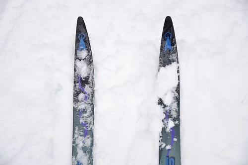
Friday, October 22, 2021

Overlander Ski Club - Early Bird Registration

Cross Country Skiing

You have until November 15, 2021 to register for a pass that includes unlimited ski and snowshoe access for the Overlander Ski Club 2021-2022 season. 

Wednesday, September 23, 2020

Time to buy your ski pass!


Registration is now open for the 2020-2021 ski season! 

Here's a direct link to purchase a pass. Visit the Overlander Ski Club website for special registration instructions for Juniors / Jackrabbits / Bunnies.  


Saturday, April 11, 2020

Reminder: Sugarloaf trails are closed!

Lac Le Jeune residents are grateful to Sugarloaf Ranch for allowing access to their trail system. Due the COVID-19 health and safety concerns, these trails are closed, just as all other recreational trails. Unfortunately, the signs are being ignored and we all risk losing this trail privilege.

These photos were shared by Will Ciancone, Ranch Manager. Local cycling groups, Kamloops Performance Cycling Centre and Kamloops Bike Riders Association, were quick to get the word out to members that this behaviour is unacceptable.

Please, do not put others at risk or jeopardize the future use of these incredible cycling opportunities in our area.

Thank you Sugarloaf Ranch for your generosity and local cycling organizations for establishing this valuable partnership and staying vigilant!


~ Sylvia Currie, with thanks to Chris Wynne for helping to get the word out.

Thursday, April 9, 2020

News Release: BC Parks Closed Until Further Notice

BC Parks Response to COVID-19 

Full BC Parks System Closure

Lac Le Jeune Park
Photo by Jacquie Brugger
BC Parks is immediately closing the entire BC Parks system, including all parks, protected areas, conservancies, recreation areas, and ecological reserves. All camping (front and backcountry) is now banned until May 31st, 2020. This action is being taken in response to the call for increased action to address the COVID-19 pandemic.

With the desire of the public to get outdoors, many parks have already experienced peak season levels of use that have resulted in overwhelmed parking lots, trails and trailheads, making physical distancing difficult, if not impossible in some locations. It has also resulted in damage to our facilities and the environment.
This closure is also necessary to ensure the continued health and safety of our visitors, employees, park operators and their staff, volunteers, and park contractors. By taking this action, we align with federal and provincial directives for people to stay home to reduce COVID-19 transmission risk.
This temporary measure means public and vehicle access is prohibited until further notice. All trails, roads, day-use areas, beaches, lakes, boat launches, and backcountry areas are closed to the public. Park closures will be enforced through regular monitoring and patrols and anyone found in a closed park will be evicted and could face a $115 fine.
In addition to the full system closure, the campground closure has been extended to May 31st, 2020. Full refunds will continue to be provided to those with existing reservations during this time. The Discover Camping reservation system has been suspended for all new reservations. A public notice will be issued once facilities are reopened and the system is able to accept new reservations.
BC Parks continues to monitor the COVID-19 pandemic closely and is following the recommendations set out by the Provincial Health Officer and the Minister of Health for decisions related to closure and reopening of parks and facilities.
Please continue to check the BC Parks website for updates.
BC Parks COVID-19 Questions and Answers: bcparks.ca/covid-19/questions-answers/
For more COVID-19 information, visit the BC Centre for Disease Control: BCCDC: http://covid-19.bccdc.ca/
Provincial Health Officer and Ministry of Health News: https://news.gov.bc.ca/ministries/health

Sunday, December 3, 2017

The Stomp Is Back!


Do you love mountain biking? This is BIG news!

After a 17-year hiatus, the Stomp Classic at the Stake Lake trails is back! Register now for the July 7th/8th race.

There are many race options to accommodate all levels:

  1. A 60km XC Mountain Bike Marathon, which includes an epic single track section and technical features you will not find elsewhere
  2. The 20km “Mediator” race 
  3. 12km “Just GO For It” loop 
  4. The 10km “Junior Trail” race 
  5. A 1.5km “Little Bikers” event
Check out the trail map. 

Saturday, November 11, 2017

Early registration for ski trail pass

Tracks
Photo by Alan Richards
Now is the time to purchase your 2017-2018 season ski pass at Stake Lake trails. Prices go up November 15th.

What do you get with a season pass? Unlimited access to:

60 km of scenic, expertly groomed skate and classic trails
5 km of dedicated dog-friendly trails
12 km of snowshoe trails
Head to the Overlander Ski club website for details and to purchase your pass!

Monday, April 24, 2017

Fishing license

Time to purchase your fishing license! 100% of the revenue generated from the sale of licenses directly benefits recreational fisheries.

 http://www.gofishbc.com/

Photo by Pierce Martin https://flic.kr/p/GZCkaQ

Wednesday, April 20, 2016

May 1st Goose Lake Road Bike Tour

The Goose Lake Road Bike Tour is organized by Kamloops Code Blue

REGISTRATION 
This is a FREE event, but riders need to register and sign a waiver to participate: 
https://www.eventbrite.ca/e/goose-lake-road-bike-tour-tickets-24722109495?aff=efbevent  
The waiver will be at the registration desk the day of the event. 

WHEN
(Registration starts at 9:30, the ride starts at 10:00.)
WHERE
Knutsford Hall - 2530 Long Lake Road, Kamloops, British Columbia 
Kamloops Code Blue wants to invite the public to join them for their inaugural event, a bicycle ride on Goose Lake Road on Sunday May 1st. Wear your own blue shirt, or purchase a Code Blue T-shirt for the ride. Nature will showcase the blue sky, wetlands, and grasslands in the beautiful surroundings of Knutsford. Between our starting point at the Knutsford Hall to our destination, Goose Lake, is a picturesque gravel road. There is a gradual change in elevation to the Peterson Creek wetlands at 6 km. The next phase includes 3 km of a winding climb amongst aspen and fir trees reaching Goose Lake by 9 km. Take a water break and mingle at our Goose Lake aid station before heading back to the Hall. Awaiting your return at Knutsford Hall is a concession lunch, refreshments and a family-friendly gathering. Come to ride or just to enjoy the day and support the event.
Riders should have skills that are appropriate for a gravel road ride with gentle hills. The Hall grounds will be a good waiting area for family, friends, and rider supports. Food and drink concession will be available for a picnic-like atmosphere. Bring your own lawn chair.


Thursday, October 1, 2015

Kamloops Bike Riders Association: Memorandum of Understanding

The Kamloops Bike Riders Association and the Lac Le Jeune Conservation Association have signed a Memorandum of Understanding (MOU) to ensure communication between the two organizations, and to provide support for KBRA in achieving their goals.


Wednesday, January 28, 2015

Logan Lake Polar Carnival 2015

Polar Carnival Buttons are on sale NOW at Esso, Grocery store, IDA, WHY, and a few other Locations around Logan Lake. You will require a button to participate in many events.

These are just some of the events. Check the Logan Lake Wellness Health and Youth Society (WHY) website for updates and details.

Thursday February 5 

  • International night starts at 5pm... Participating restaurants: 
    • Old Village Café-Ukrainian
      • Black Bull-Italian
      • Aardvarks-Thai, 
      • Little Baileys-Greek
LL High School
  • 430-530 Literacy Family Night. 
Black Bull and Pick n' Shovel
  • Darts 7pm
50/50 Draw starts (get tickets at the WHY)
Scavenger Hunt starts (pick up sheets @ WHY or HUB International by 4pm)

Friday February 6

LL Elementary school
  • 6pm grad class concession/bake sale 
  • 6-7pm Kids Carnival games, magician& Fun Zone blow up 7-745pm Family glow stick dance 
LL Seniors Centre
  • 6:30-9pm Social (wine&cheese) Music by Fern 

Saturday February 7

LL Seniors Centre
  • 8-11am Pancake Breakfast (must have Polar Carnival Button) 
  • Horse drop Bingo Squares for sale 
LL Library
  • 11am -1pm Polar Carnival Posters/videos 
Rec Centre Outdoors
  • 12-2pm Family games ( see flyer for a list of games) 
  • Adult warming station at fire pit 
  • 1pm Horse drop Bingo 
  • 2pm Chili cook off (judging) 
Rec Center Indoors
  • Hockey games throughout the day 
  • Minor Hockey concession open 
  • 12-2pm Face painting 
  • 1:00 pm LL Arts Council Arts and Crafts (curling viewing area) 
  • 130-3pm Scavenger Hunt winner announced 
  • 1:45pm Polar Carnival Passport station open (bring your passport and receive a treat) 
  • 50/50 Draw at end of day (if not claimed number will be posted at the WHY)
Questions? call the WHY office at 250.523.6229

Tuesday, January 13, 2015

Improving information for snowmobilers

This request, posted to the Kamloops Snowmobile Association website before the new year, caught my attention:

(from the KSA News: Private Land Issue)
I have property at Lac Le Jeune at the west end of the lake. each year I have problems with snowmobilers trespassing on my private property. I have it signed and posted with No Snowmobiling or No trespassing signs. It seems as if once they get on a machine they lose their ability to read. Have you any suggestions to alleviate the problem? 
The Ridge Mountain Forest Service Road goes through our place, and as long as they stay on the part of the road that is not maintained I have no problem, but unfortunately, many of them do not. I do not want to involve the police, and with help I would rather solve the problem at this level. 
I would appreciate a response so we could talk this over. I realize that it is probably not your members that create a problem but maybe they have some ideas that would help 
Thank you very much 
Jocko Creek Ranch
https://flic.kr/p/bnYwVa
I don't know the outcome of this request, but it occurs to me that signage isn't the complete solution. The question of where snowmobiles are permitted in the Lac Le Jeune area has been raised over the years. Some areas are obviously off limits, yet in other areas it's not always clear. For example from the lake, snowmobilers often weave in and out of the provincial park. There are no signs; they might not even know it's a park.

It seems that anyone venturing out on snowmobiles in a new area would first research trails systems and locate the staging areas. As someone who knows very little about snowmobiling, I thought I would do a quick search to see what information is readily available.
I started with the Kamloops Snowmobile Association (KSA) website since they have a stewardship role. This is the description of the Lac Le Jeune area on the Kamloops Snowmobile Association website:
Located 20 minutes south of Kamloops, the Lac Le Jeune area snowmobile trails run generally towards the south and east of Lac Le Jeune. The elevation is 1300m to 1680m, there are many other users in the immediate area of Lac Le Jeune that must be respected. There are cross country ski trail systems and local residents. This area is managed by agreement with the KSA (Kamloops Snowmobile Association) and MoTSA (Ministry of Tourism, Sports, and the Arts. Once you are far enough south of Lac Le Jeune conflicts are not an issue (obey signage). The ungroomed trail system runs through picturesque rolling plateau terrain on unplowed forest industry and ranching roads, through numerous meadow complexes, lakes and old forest fire burns. Sightings of moose are common in this area, ice fishing is also popular. This area is also accessed through Edith Lake and Rossmore Lake.
The Sun Peaks section on the KSA site includes maps in various formats: PDF for download, GPX for GPS devices, and KML for importing to Google Earth. That's useful! But nothing for Lac Le Jeune.

The next logical step was to check the Ministry of Tourism, Sports, and the Arts referred to on the KSA website. It's now called Ministry of Community, Sport and Cultural Development. That ministry doesn't seem to deal with anything related to snowmobiling. Rather, the focus is on competitive sports.

I then checked the BC Recreation Sites and Trails website,  which is part of the Ministry of Forests, Lands and Natural Resources Operations. Oh good, it's an interactive site! I clicked on "planning your trip" then selected activity type: Snowmobiling and region: Southern Interior West. No mention of Lac Le Jeune... or Logan Lake... hmmm.

The advice on the BC Snowmobiling page on the Ministry of Environment website (so many ministries, so little time! :D) gives the following advice for people exploring new areas:
  • actively seek out local recreation maps for the area you will be visiting 
  • respect and protect all local land use signage 
  • avoid entering designated non-motorized areas 
https://flic.kr/p/eQsEFe
This is good advice if you have 1) maps, and 2) good signage. It would also be helpful if they would provide links to places you can find these recreation maps. A search looped me back to the BC Recreation Sites and Trails website. Sigh.

As far as I can tell, from the KSA website and other recreation and government sites, there are no area maps available for Lac Le Jeune. There are also no concise resources that educate visitors and newcomers to our area about where snowmobiles are permitted. I found lots of websites, loops, broken links, and heaps of descriptive text -- it's a lot to navigate and make sense of. And in the end, none of it was helpful for someone considering a snowmobile trip to the Lac Le Jeune area.

It seems better information (along with good signage) would be a big step in the right direction to solving this problem.

Help please! Where can we find useful information and maps for visitors and newcomers to Lac Le Jeune? If it doesn't exist, how can we work together to create it? 

Sylvia Currie

Monday, July 7, 2014

Goose Lake

"Honkers" by Gerry
This recent blog post — whither Goose Lake Road? — by Mel Rothenburger includes some interesting history on the Goose Lake area.